Based in NYC and providing service nationwide. New York | New Jersey | Philadelphia | Atlanta | Miami. Known for safe expert inner city operations, delivering in time sensitive and demanding situations with 110% focus on safety and client deliverables
Aerial Cinematography & Video Service
We have a variety of packages from full setup with a crew of 3 (Drone Op, Camera Tech Op & Visual Observer) for more technical filming. Also providing discrete effective filming for astonishing results in the NYC area. Our work is in continuous films, TV & marketing as we have some of the most captivating aerial content!

Governores BALL nyc

Brooklyn Event

Brooklyn Event
FPV 360 VR Cinematic Flythrough Tour
The dynamic revolutionary 360 VR drone marketing service! This First Person View fly through of indoor space especially, is a new intriguing & captivating way of marketing with the latest technology!
Photography & Photogrammetry Service
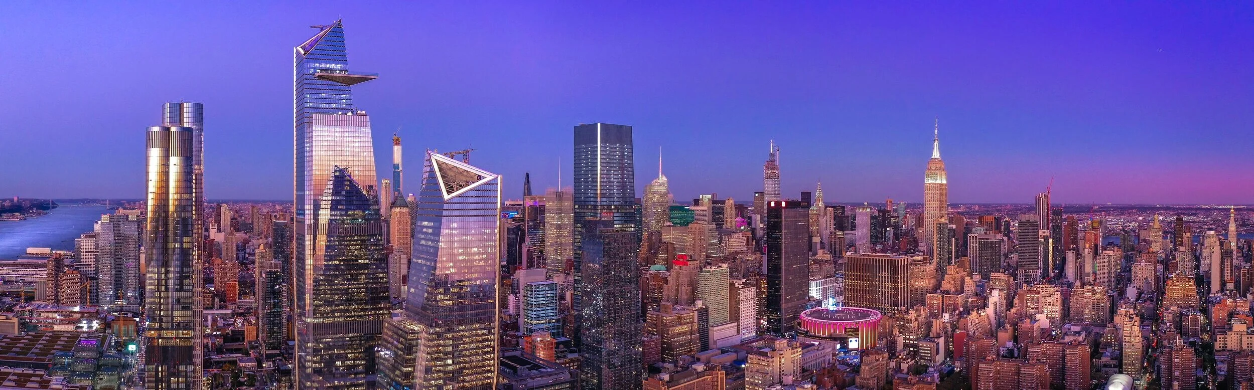
Producing stunning images of NYC with a variety of camera drones for the project work order. Captures for Context / Backplate / Rendering Imaging, 360 Panoramic Elevation Tours, CRE Marketing, Site Development, Inspection. Photogrammetry Surveying including measurement, volumetric & Topo. LiDAR and thermal with the latest technology of equipment, execution and result.
Drone Construction Monitoring & Development Progression
With advanced breakthrough drone technology for Aerial Video Photography, ortho mapping, documentation, inspection, survey, monitoring, hyperlapse progression & a host of other services provided by Aerial VP drone service on the construction site. This service provides Safe, Accurate, Fast, Efficient results saving time and expense of the project.

Continually Provide service for construction Development, documentation & progression

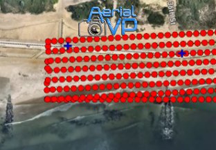
Aerial Drone Mapping Service
Orthomosaic mapping survey for measurement, volumetric & topography maps. This process is done in a fraction of the time of traditional methods using photogrammetry & or LiDAR saving time and expenses, producing a Digital Twin data deliverable from a birds eye 3D view of the project.
This is the a point cloud from part of a coastal aerial survey contract.

This is a DTM to topo delivarable from a coastal aerial survey contract provieded by Aerial VP.
Drone Infrastructure & Façade Inspection

This image was produceed for high altitude inspection.

Aerial VP infrastructure Inspection & survey
20mp zoom camera from the latest Tech for inspection

Infrastructure Inspection.
Aerial VP Facade Inspection

Aerial VP was hired for imaging of Koscuiuszko Bridge
LiDAR - Thermal - Inspection
With the latest technology of drone inspection equipment for retrieving indispensable ROI data in a Safe, Accurate, Fast, Efficient manner. Collecting data for façade, building, construction, industrial, solar, wind turbine and land to name a few. Commercial inspection data will provide current and future cost savings, identifying present & future issues. All videos & images from in house equipment from past inspection service by Aerial VP.
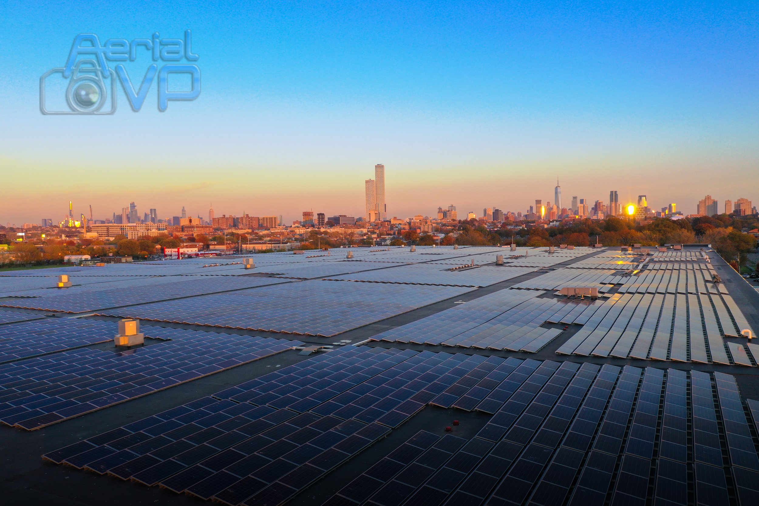
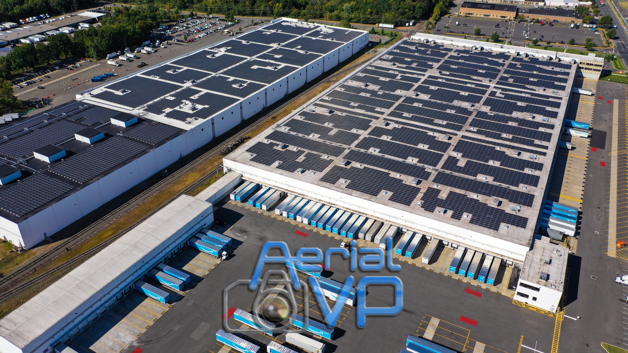
Solar PV Inspection

This thermal image shows issues with some of the cells on this panel.
Utilities - Line & Tower Inspection
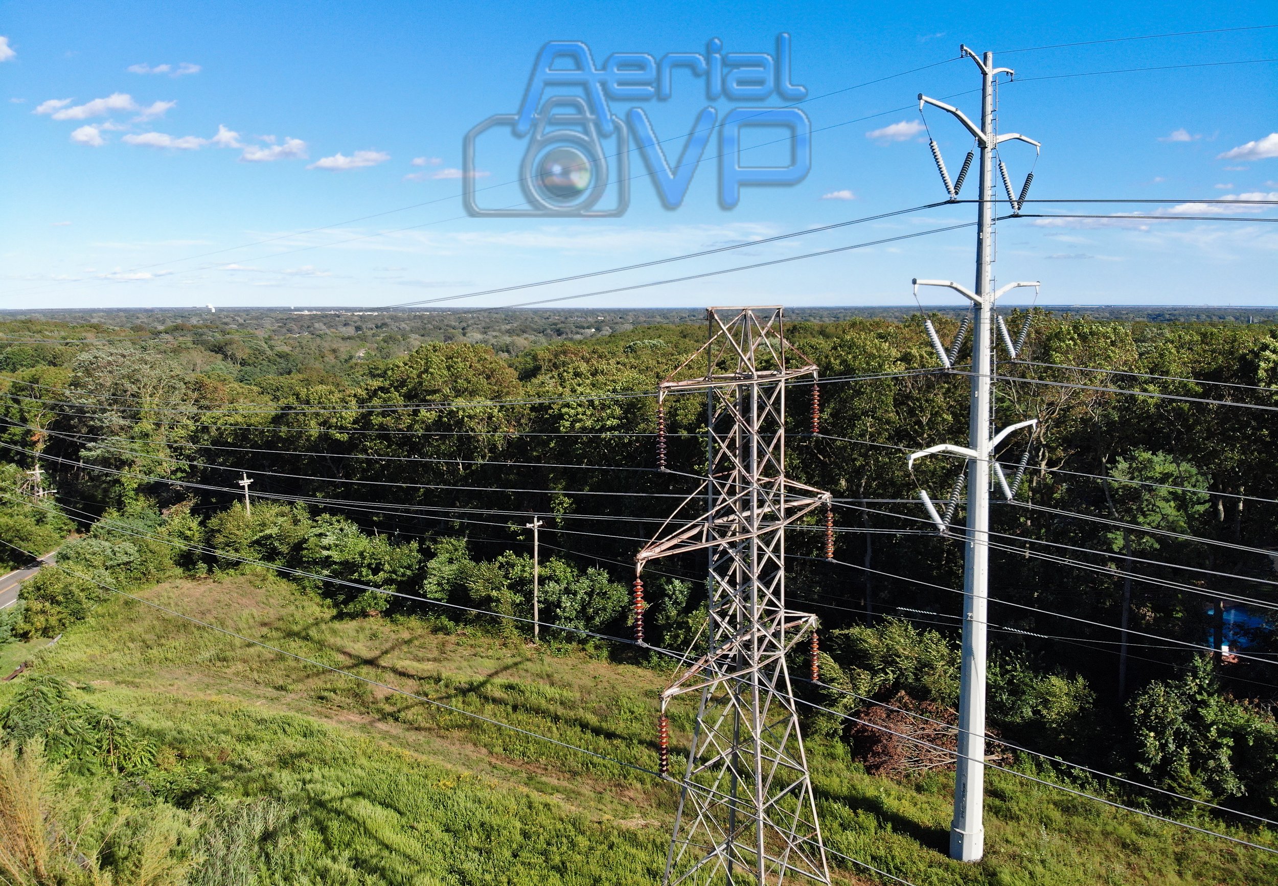
Line Inspection with the latest Drone tech

Covering thermal images, readings from the same camera as zoom for fast & effective deliverables from one source.
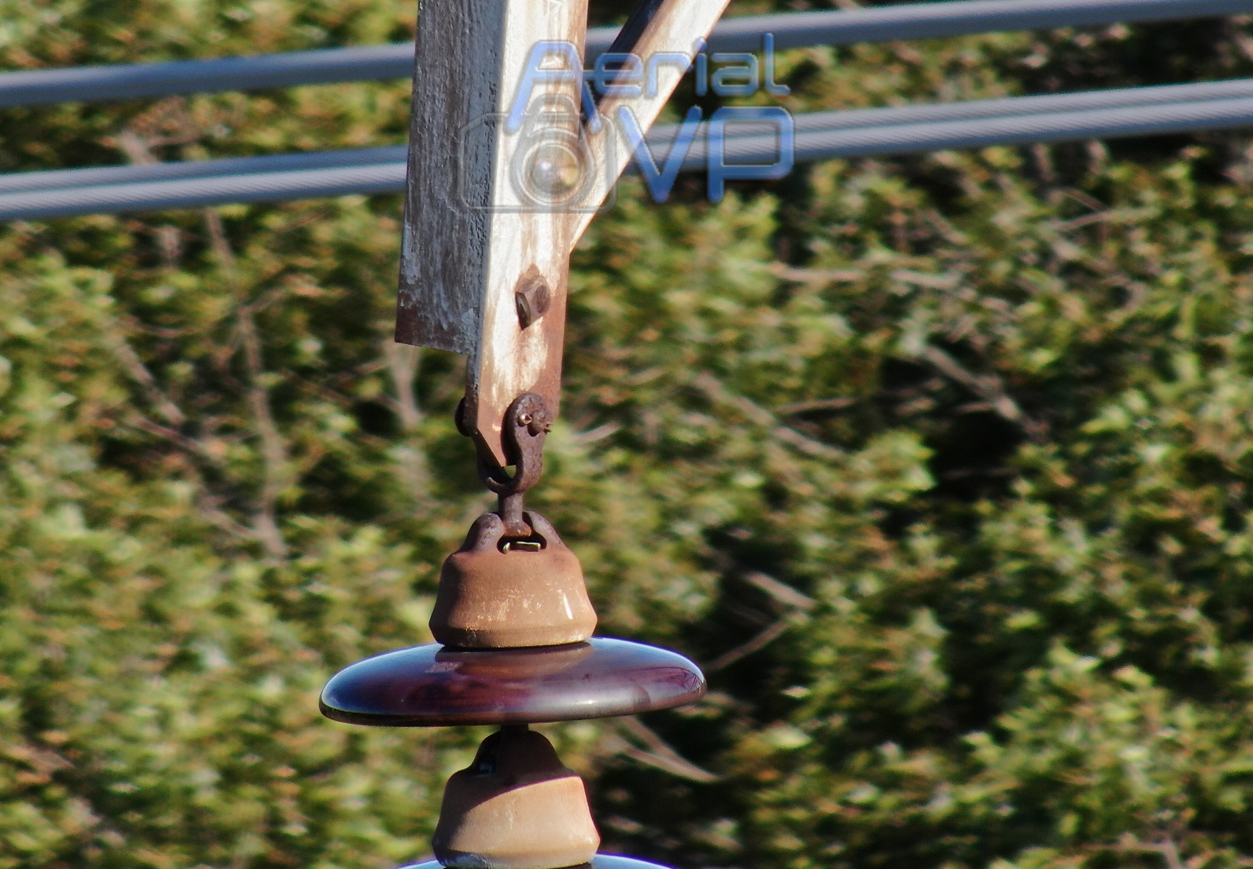
This image is from the camera zoom capabilities over 200 ft.